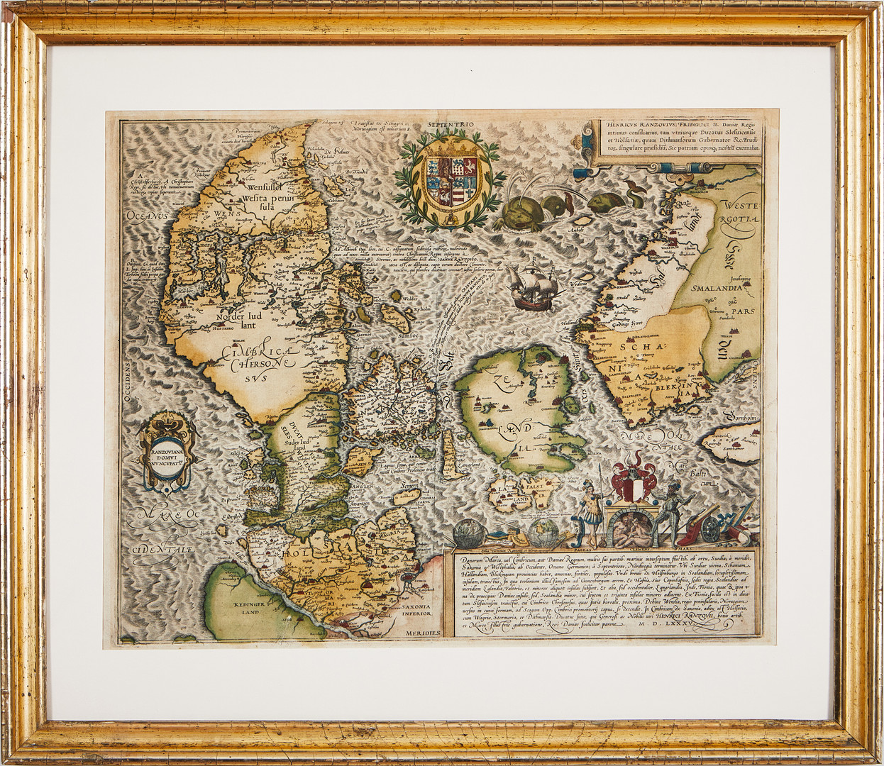
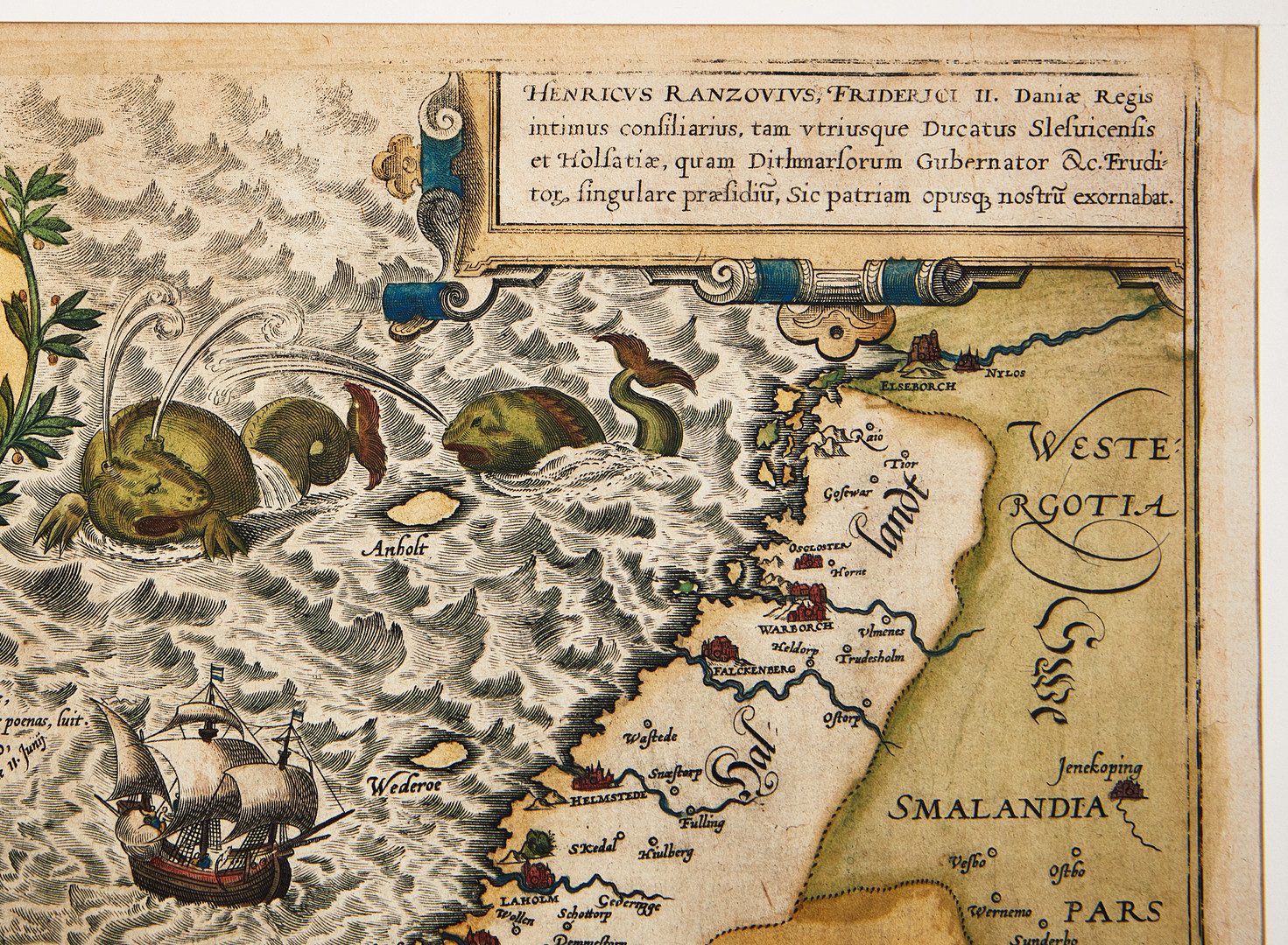
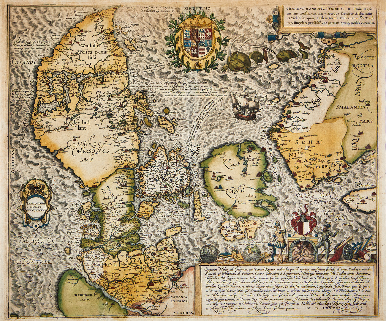
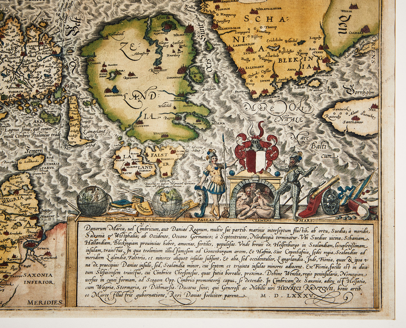
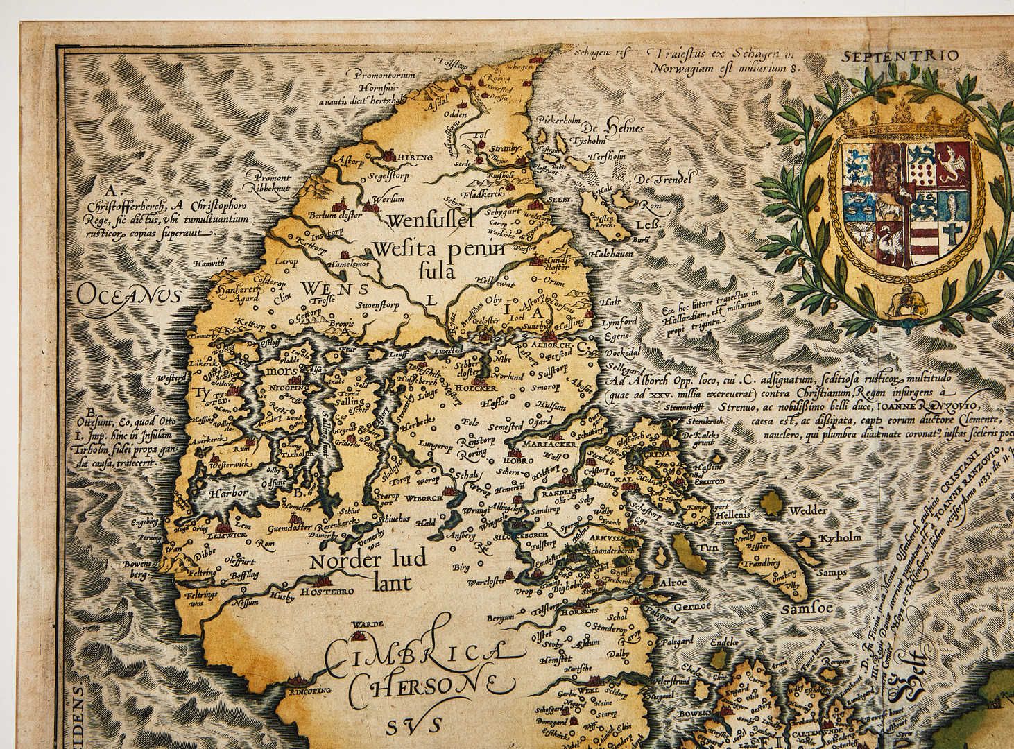


OLDEST PRINTED MAP OF DENMARK, BRAUN-HOGENBERG, Danorum Marca, ca 1590.
Korkein tarjous | 18 600 SEK |
---|---|
Klubbas | Valmis |
Hus | Stockholms Auktionsverk Nybrogatan 32 |
Föremålet har klubbats. |
DENMARK. BRAUN, GEORG - HOGENBERG, FRANS - JORDAN, MARCUS. Danorum Marca, uel Cimbricum, aut Daniae Regnum... Cologne c. 1590.
Hand-coloured engraved map with large figurative cartouche, coat-of-arms, sailing ship and sea-beasts. About 390x470 mm. Small part of left lower corner broken, as they are in all editions. Centrefold as published, small part of upper fold repaired, small hole and scratch damage to lower left part (near Stade), some minor spots. Framed.
Bramsen, p. 58-61. Ginsberg p. 105 and image no. 24.9.
This map of Denmark by Marcus Jordan is the only actual map featured in Braun and Hogenberg´s atlas Civitates Orbis Terrarum, first published 1588. Rantzau´s coat of arms is surrounded by Athena and Ares on the cartouche at bottom right. After a drawing by Marcus Jordan who count von Rantzau (the Danish govenor in Schleswig-Holstein) commissioned to draw the map.
Not examined out of frame.
See text. Not examined out of frame.