BLAEU, WILLEM - JOAN. 14 engraved plates from Blaeu' Atlas Maior. Amsterdam 1664. (Tycho Brahe's Scientific instruments).
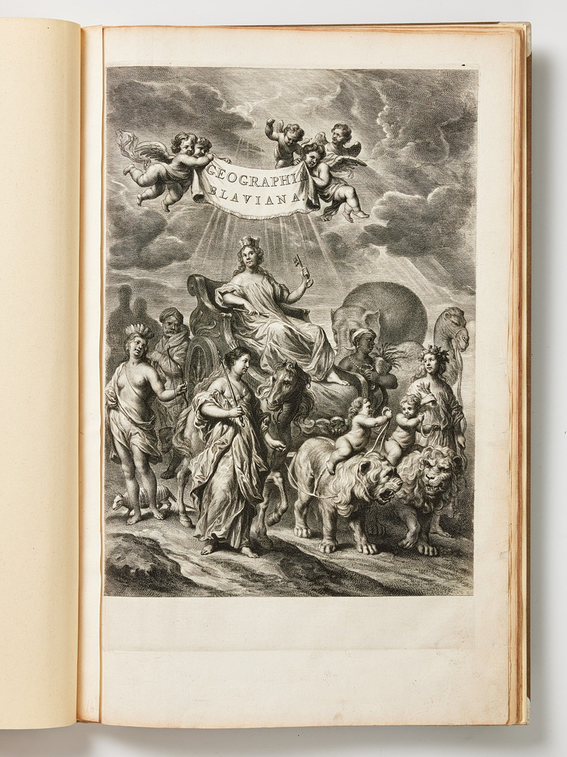
Folio (c. 565 x 370 mm. binding). Consists of: Engraved title to "Geographia Blaviana" (a few small repairs to the outer margin, a with minor loss); 3 title leaves (Aerdklootsbeschryving, welck is het eerste deel... , Eerste deel des Aerdklootsbeschryving, Amsterdam, Blaeu, 1664, with printer's device, Eerste stuck der Aerdrycksbeschryving, Amsterdam, Blaeu, 1664, with printer's device; pp. 17-50.
14 contemporary engraved plans and plates of Tycho Brahe's scientific instruments and astronomical observatory including map of the island of Hven and Uraniborg (Uranienborg), of which 5 double-page, 1 text illustration. Size about 420x530 mm for double page plates, and 273x420 mm. Text leaves paginated 17-50. Dutch edition.
See all plates with titles below.
Bound in 20th century half vellum binding, only slight wear. Beige cloth case, partly browned.
Together with the plate "Ichnographia praecipuae domus arcis Uraniburgi", handcoloured engraved plate (centrefold, tears to margins which is browned, latin edition).
These plates were included in Blaeu's Atlas Major which was published in 12 volumes between 1662 and 1667. The present come from the first part containing Arctica and Europa, books 1-2 (Norway, Denmark, Sleswig) and with a separate chapter on the Danish astronomer Tycho Brahe, who was Blaeus former teacher.
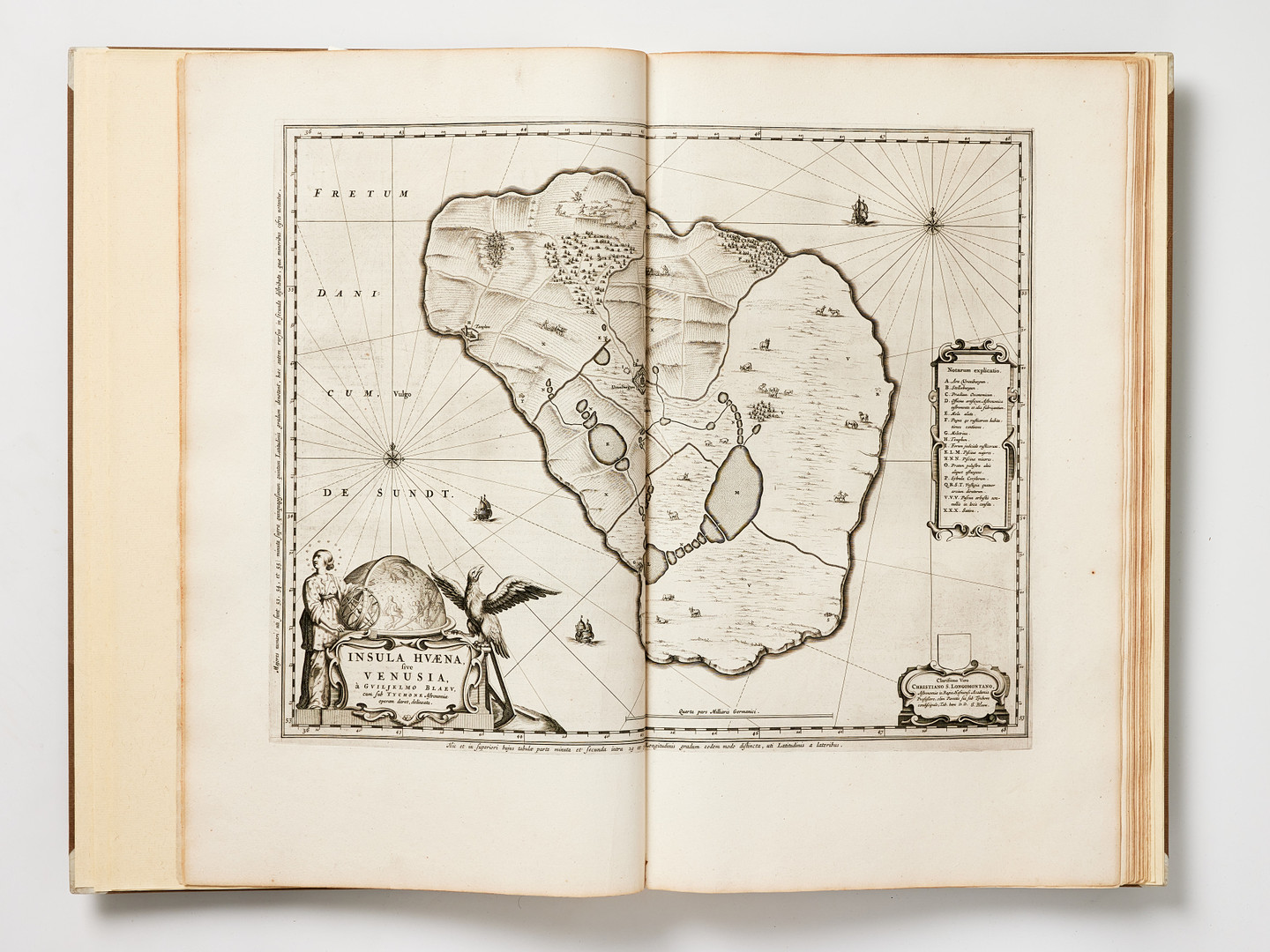
Tycho Brahe (1546 - 1601), worked from 1576-97 on the island of Hven (Ven), where he constructed his observatories
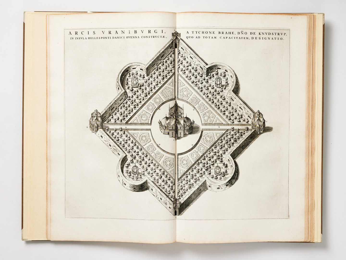
The observatory and mansion named Uranienborg, after Urania, the muse of astronomy, was the first building in Scandinavia in Gothic Renaissance style. Researchers and and students from abroad, especially the Netherlands and Germany, visited Hven to study the construction of astronomical instruments, the techniques and astronomical observations---. Willem Blaeu spent the winter 1595-96 on Hven as Brahe's student and probably drew his map of Hven then, perhaps copying that of his teacher, published in 1596.--- The map of Hven was probably Willem Blaeu's very first map. The cartographic publishing house of Willem Blaeu and his sons would become one of the most important mapmaking establishments in the world in the seventeenth century (Geographers Biobibliographical Studies, vol. 27, Ed. Withers - Lorimer).
Plates and maps included:
1. Insula Hvaena sive Venusia (double-page)
2. Arcis Uraniburgi (double-page)
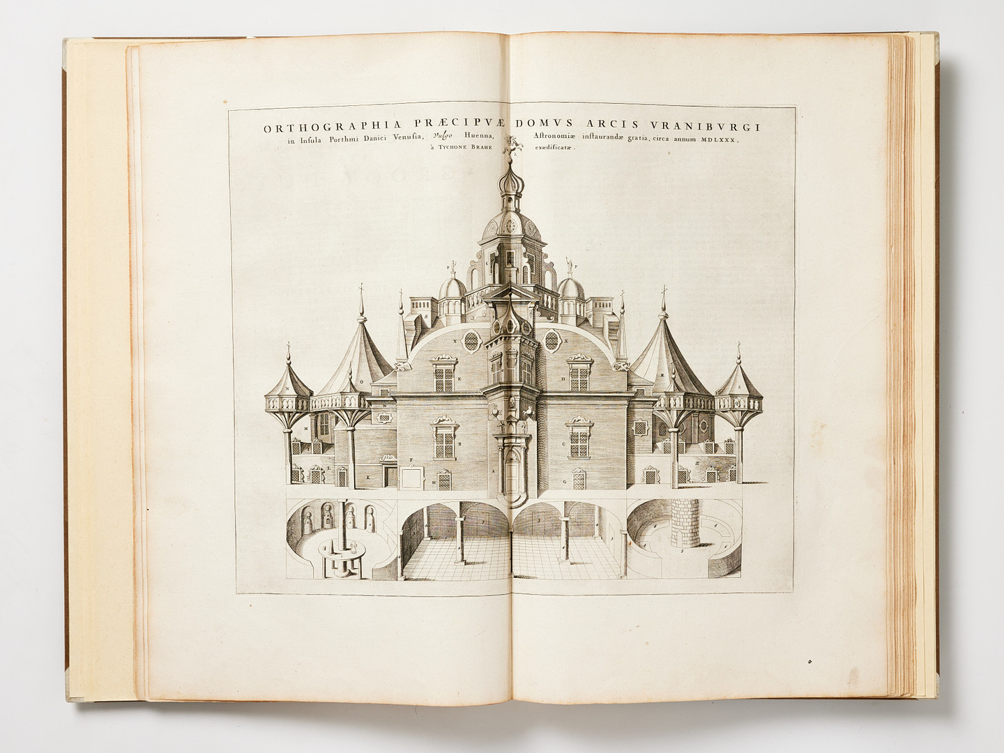
3. Orthographia praecipuae domus arcis Uraniburgi (double-page)
4. Ichnographia praecipuae domus arcis Uraniburgi (double-page)
5. Sextans astronomicus prout altitudinibus inservit
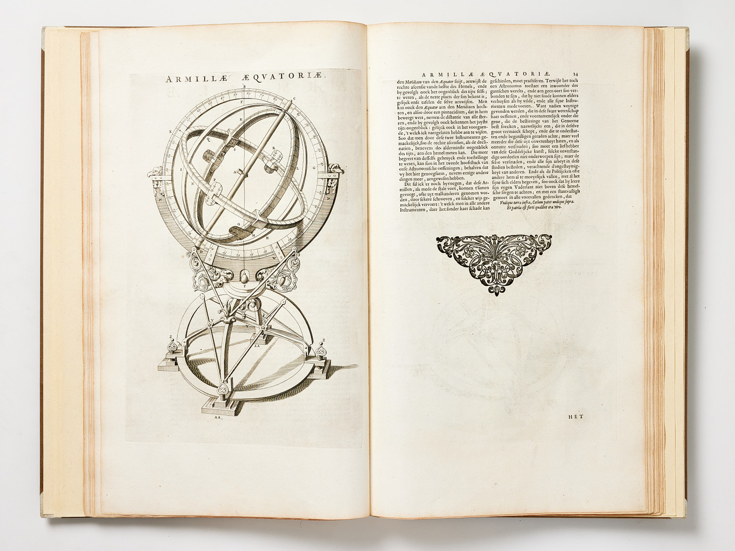
6. Armillae Aeqvatoriae
7. Instrumentum parallaticum + Instrumentum parallaticum Tychonis Brahe (2 engravings on 1 plate)
8. Armailla Aeqvatoriae
9. Effigies Tyhonis Brahe
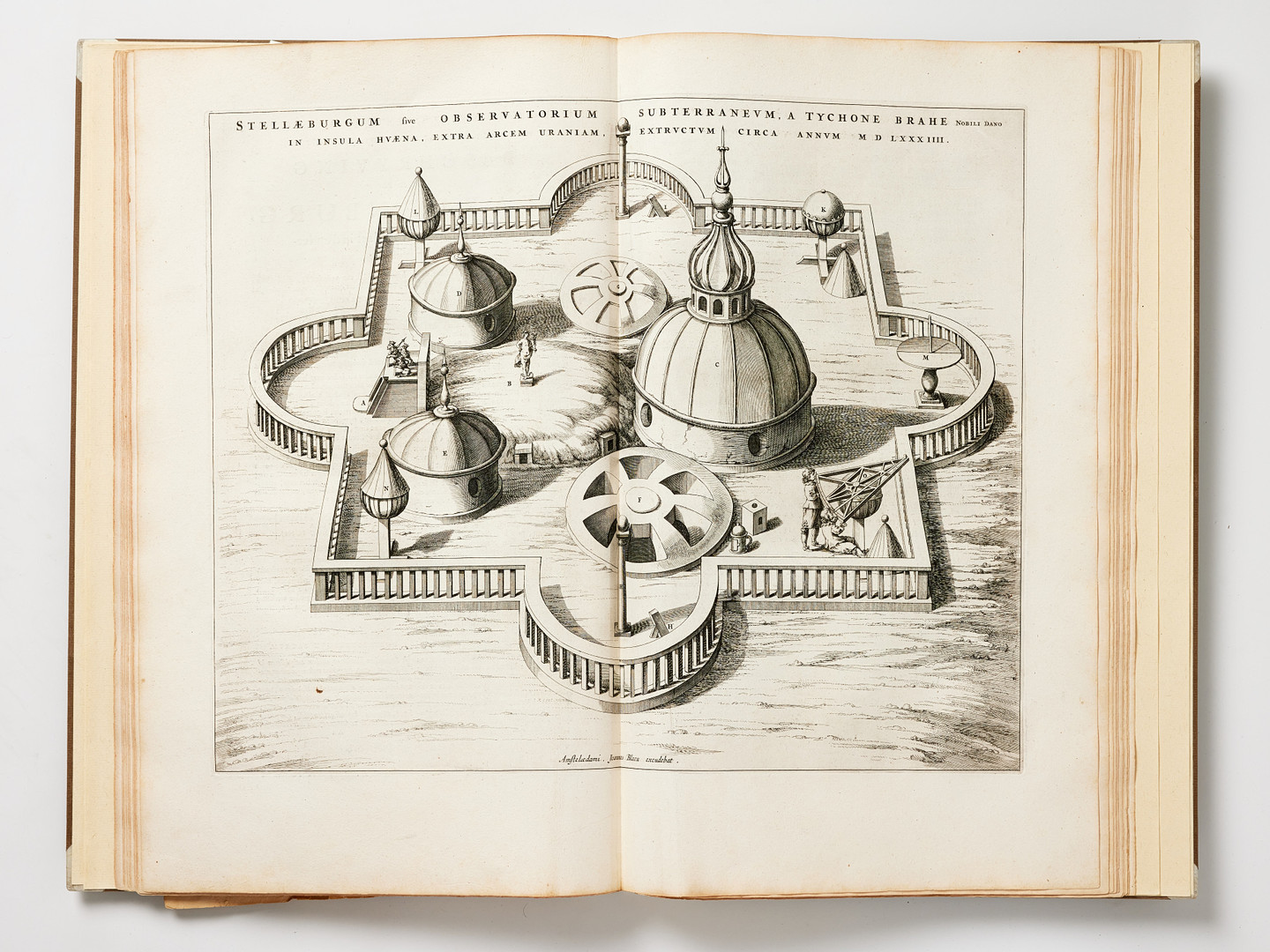
10. Stellaeburgum sive Observatorium subterraneum, a Tychone Brahe (double-page)
11. Iconographia Stellaeburgi (engraved illustration, ca 265x260 mm. in text)
12. Armillae aeqvatoriae maximae
13. Sextans astronomicus trigonicus
14. Qvadrans magnus chalibeus
15. Qvadrans volubilis Azimutalis.